|
The Wrack Line is a newsletter for partners, participants, and data users of NOAA's Marine Debris Monitoring and Assessment Project (MDMAP). Thank you for reading!
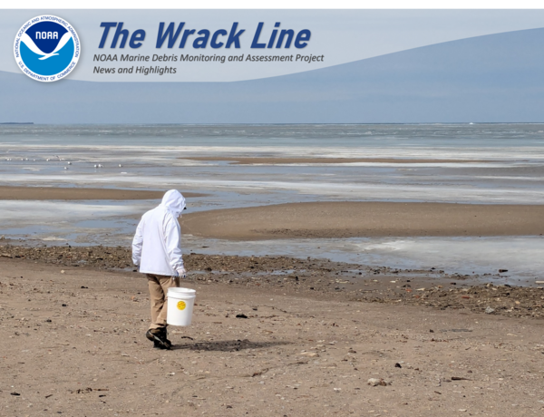
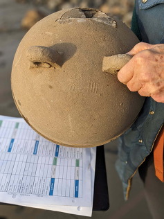
A participant walks along a transect during an MDMAP survey in Port Clinton, Ohio. Photo Credit: Old Woman Creek National Estuarine Research Reserve.
MDMAP Nationwide Survey Updates
The MDMAP Nationwide Survey is an effort in partnership with @Orchard to conduct marine debris surveys along coastlines across the country from American Samoa to Maine. We’ve captured recent project highlights and progress below. You can read about the background and importance of this project here.
Hot off the Presses!
Most marine debris monitoring programs do not use strong statistical design, which limits how useful their data can be. Without delving into extensive technical detail, this recent article in Marine Pollution Bulletin describes NOAA’s approach for developing the scientifically robust MDMAP Nationwide Survey to estimate shoreline debris status and trends in the United States at a large scale. The article explains the value of this process and encourages entities to conduct monitoring as a rigorous scientific endeavor, such that the data can inform management decisions.
While the full design includes detailed statistical methods, the key elements are:
- 10 regions, each with 62 survey sites
- 12 sites surveyed every year, with surveys conducted quarterly
- 50 sites surveyed once every five years
- A design that produces reliable estimates of current conditions and long-term trends
Although this exact approach may not work everywhere, the underlying methods can be adapted for other monitoring programs. Want more depth on the statistical foundations of this design? A copy of the article can be requested by emailing marine.debris.research@noaa.gov.
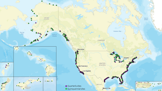 Map of the nationwide survey sites. Each circle represents one site. The 12 quarterly sites in each region (quarterly sampling replication in all years) are illustrated with magenta circles, whereas the 50 sites that are sampled once every 5 years with no replication are depicted as green circles.
Highlights of the MDMAP Nationwide Survey:
The @Orchard field teams have begun collecting samples for the third quarter of the project. So far they have:
- Established 416 of the 620 sites
- Conducted 581 surveys
As one may imagine, they’ve seen a fair share of the common debris types: plastic bottles, cigarette butts, and hard fragments. Our team wanted to highlight some of the novel finds the @Orchard surveyors have come across since the start of their sampling in July 2025.
|
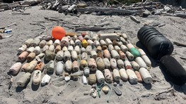
Surveyors found nearly 100 buoys within their selected transects on Santa Rosa Island, California, in August 2025. They took care to count hard buoys separate from foam buoys to inform the custom items within the “Buoys & Floats” category.
Photo Credit: @Orchard/Rincon
|
|
 |
|
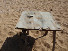
We can only wonder what conversations, games, or meals were shared over this makeshift table found during a November 2025 survey in Loíza, Puerto Rico. Since it was solely a plywood board supported by pieces of unprocessed wood, the table top was logged as “Processed Wood - Lumber & Building” and the legs were not counted as marine debris.
Photo Credit: @Orchard
|
|
 |
|
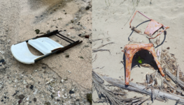
What’s a table without chairs?
So far, surveyors with the MDMAP Nationwide Survey have seen three chairs across two sites. In September 2025, two metal chairs (right) were observed on a beach in Arecibo, Puerto Rico. One month later and 7,242 miles from that survey, a plastic chair (left) was seen at a site in Lauli'i, Eastern District American Samoa. The chairs were categorized as “Other Metal” and “Other Plastic,” respectively.
Photo Credit: @Orchard/Dawson
|
|
 |
|
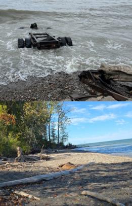
An old truck axle was observed in the swash zone at a site in Mentor, Ohio and was categorized as “Other Metal.”
This truck was noted during the team’s first survey in August 2025 (top photo), and upon their return in mid-October, they found the truck pieces partially buried under the sand (bottom photo). This is a prime example of how dynamic coastlines can be!
Photo Credit: @Orchard/Great Lakes Environmental Center
|
|
 |
Beyond the debris, they have also had some exciting experiences getting to their sites and encountering wildlife.
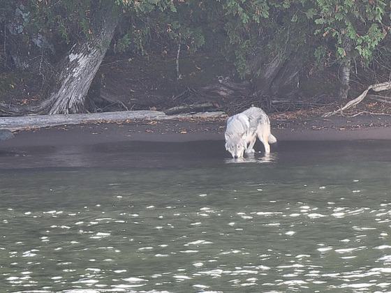 One of three gray wolves seen on an Isle Royale National Park shoreline in Michigan. Photo Credit: @Orchard/Great Lakes Environmental Center
As field staff in the Great Lakes sailed along the coast of Isle Royale National Park in October 2025, they saw three gray wolves (Canis lupus) taking a sip from Lake Superior.
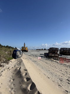
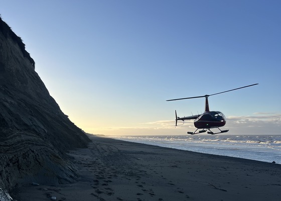 A helicopter landing on a shoreline in Alaska. Photo Credit: @Orchard/DOWL LLC
The Shoreline Site Characterization Form asks surveyors to mark how accessible the site is, with choices ranging from “within a short walk” to “plane or boat access only.” Field teams in Alaska use helicopters to access a majority of their sites. On top of their MDMAP survey, they need to conduct a visual survey before landing to ensure the coast is clear of any protected seabirds, polar bears, pinniped rookeries, and major pinniped haul-outs.
Participant Highlights
A Long Way from Home
A surveyor in Netarts, Oregon found a buoy during a survey last December. There is script on the surface indicating that this buoy originated in the western Pacific Ocean.
Credit: Gwen S. of Netarts Bay WEBS
|
|
 |
Feathered Project Managers
Wolves aren’t the only animals survey teams have seen out in the field! This past winter, a surveyor with the Old Woman Creek National Estuarine Research Reserve was joined by a pair of bald eagles (Haliaeetus leucocephalus) during their December survey in Huron, Ohio.
Credit: Lindsey A.
|
|
 |
Interrupted Surveys
Surveyors in Delray Beach, Florida arrived ready for their March survey only to find active construction taking place!
Unable to complete their regular survey, they reached out to the MDMAP team to determine the best next steps.
If you encounter something like this while trying to access your site, we recommend returning on a different day once the construction clears. If you’re no longer able to access the site due to whatever is built, please connect with our team to update the site details and help you find a new survey site.
Credit: Karley K.
|
|
 |
Traveling Trash Webinar Recording Now Available!
Back in February, the Oregon Coast Aquarium hosted Shelby Smith’s presentation on her findings after a year of MDMAP and Nurdle Patrol surveys. She discussed the use of tidal and weather conditions to assess debris accumulation trends across two sites along the Oregon Coast and highlighted an area with a surprising number of nurdles!
If you missed it, you can still tune into the recording!
New Custom Items in the Database
Cigarette butts are a common debris item that make up about 3% of the observed debris in MDMAP surveys (as of March 2026). However, surveyors across many teams and regions are seeing an uptick in smoking-adjacent items littered along their shorelines. As alternatives to cigarettes emerge, it’s important that these be consistently categorized in the database. This may be difficult due to how much these items vary, so our team has added new custom categories to better track these items.
Read below to see how to categorize these items in your surveys. We’ve provided a general description of the item, example notes, and guidance on categorizing the items whether you’re using the default item list or custom categories. Keep in mind that the categorization depends on what material they’re made out of, so we recommend making detailed observations and, if possible, taking photos of what you find!
|
Item: E-cigarettes and Cartridges
|
|
About the Item: E-cigarettes/vapor pens are handheld battery-operated devices that come in many shapes. They can be a single-use unit, refillable, or have cartridges that detach from the main battery. While there is a wide range of appearances, each e-cigarette has a battery for power and a mouthpiece for the user to draw the vapor from.
Before choosing a category, determine the dominant material on the outside of the object. Is the outer case made of metal or plastic? If you have only found a cartridge, try tapping on the outer casing to see if it’s made of glass or plastic.
|
|
Categorization:
Whole E-Cigarette
- Default List:
- Other Plastic
- Other Metal
- Custom Categories:
- Other Plastic - E-cigarettes and cartridges
- Other Metal - E-cigarettes and cartridges
Cartridge Only
- Default List:
- Other Plastic
- Other Glass
- Custom Categories:
- Other Plastic - E-cigarettes and cartridges
- Other Glass - E-cigarettes and cartridges
|
|
Example Notes:
- "E-cigarette had a plastic outer casing, logged as ‘Other Plastic’"
- "’Other Glass’ was an e-cigarette cartridge”
- “‘Other Plastic’ item was a vape pen”
- “Pink item in the photo was a vape found on the main beach”
|
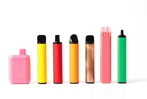 Examples of how e-cigarettes, also known as “vapes,” vary in color, shape, and size. Photo Credit: YarikL via Adobe Stock.
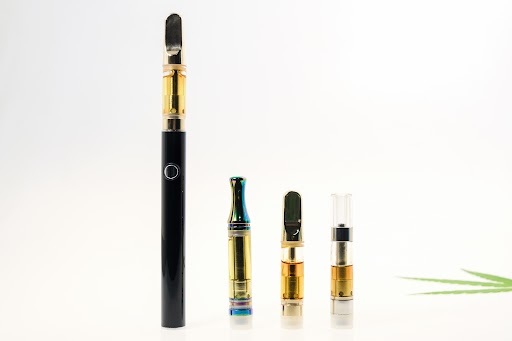 An example of an e-cigarette (left) next to removable cartridges. The cartridges (three items on the right) are disposable once empty and are intended to be used with a reusable battery. Photo Credit: wimage72 via Adobe Stock
|
Item: Nicotine/Tobacco Pouches
|
|
About the Item: These pouches can be made of a plant fiber or other fiber blends, which can feel similar to paper. Because of this, they cannot be assigned to a specific material category. Pouches can be filled with a variety of nicotine powders, tobacco, and flavor-enhancing ingredients. When used, pouches are placed into the mouth and lodged between the cheek and gums. With that in mind, we recommend that you wear gloves when handling these items, as residual saliva may contain biohazards or other pathogens.
Note that the container for these pouches should be logged under “Plastic - Other Jugs/Containers” or “Other Metal,” depending on what material they’re made of.
|
|
Categorization:
- Default List: Unclassifiable
- Custom Categories:
- Unclassifiable - Nicotine/Tobacco Pouches
|
|
Example Notes:
-
“3 nicotine pouches were found in the back barrier, marked as ‘Unclassifiable’”
-
“Found a plastic jar for chewable nicotine pouches, classified the jar as ‘Other Jugs/Containers’”
|
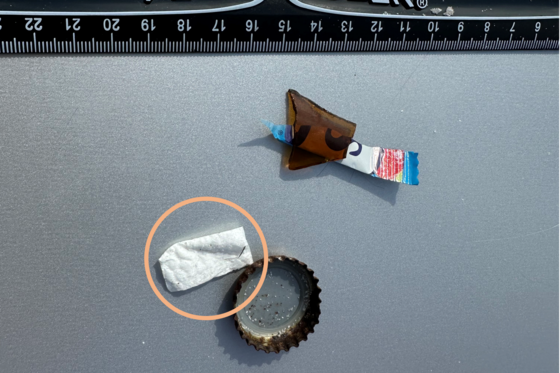 Debris composite showing a nicotine pouch circled in orange found during an MDMAP survey conducted in Florida in August 2025 by Melissa and Max W. Note that the ruler in the photo shows inches on top and centimeters on the bottom.
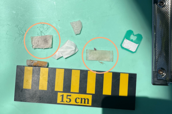 Debris composite, including 2 nicotine pouches circled in orange, from a September 2025 survey conducted by @Orchard/Dawson in Hawaiʻi as part of the MDMAP Nationwide Survey. For scale, note that the ruler is in centimeters.
As always, if you aren’t sure how to categorize any item, we recommend marking it as “Unclassifiable” on the datasheet, describing it in the notes, and, when possible, snapping a picture of it so our team can help.
If there is a custom item you’d like to track in your surveys, reach out to our team!
Training Videos
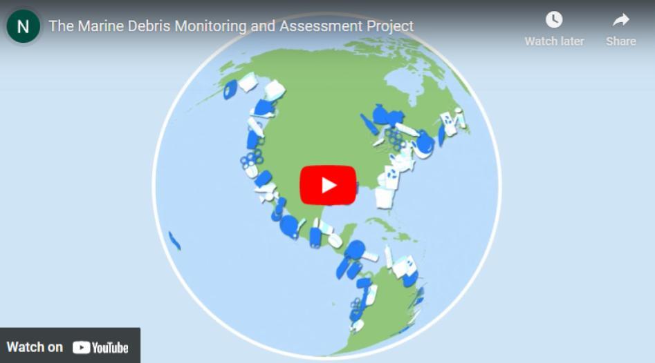
Project Video
Click on the image below to view a short video about MDMAP. Share the link to spread the word about this project!
|