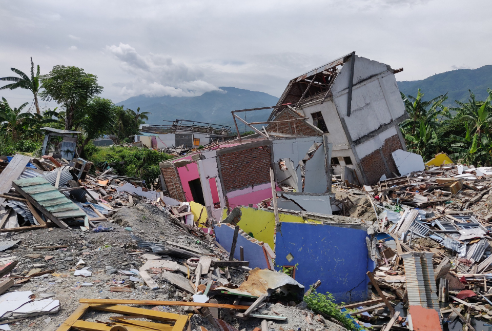
Indonesia is one of the world’s most hazard-prone nations and experiences over 2000 disasters annually. Natural hazard disasters in Indonesia are responsible for the loss of hundreds to thousands of lives each year and costs the national economy US$1 to
US$3 billion.
A new White Paper, co-developed by Indonesian and UK hazard experts, presents a strategic roadmap to significantly reduce the impacts of geological hazards in Indonesia.
|
|
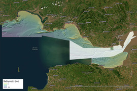
Renewable energy infrastructure, whether on- or offshore, requires in-depth understanding and accurate characterisation of the underlying geology.
To support policy and decision makers in this region, BGS has released an enhanced seabed geology map of the Bristol Channel, almost four times the size of the original, which extends from Carmarthen Bay to Newport and further south to the coast of Somerset.
|
|
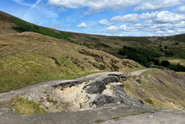
Landslides cause significant disruption to the road and rail network across Great Britain. Identifying active slope failure is a difficult task, as monitoring is costly and time consuming, especially at a national scale.
In collaboration with the University of Florence in Italy, BGS has used a new, semi-automated method that uses artificial intelligence to identify the slopes that are actively moving, highlighting areas potentially at risk.
|
|
|
In other news

Sinking Indian megacities
Ground subsidence is an increasingly important hazard in cities around the world. Satellite measurements of ground movements show dramatic levels of sinking in five Indian cities and are used to map the risk of damage to buildings in these cities. Nature Sustainability recently contacted BGS to provide an opinion piece on this phenomenon.
|

Dr Angela Lamb appointed as honorary professor by the University of Nottingham
The University of Nottingham has appointed BGS’s senior isotope research geochemist, Angela Lamb, as an honorary professor. As part of her role, Angela will contribute to undergraduate and postgraduate teaching alongside facilitating collaborative research programmes between BGS and the University of Nottingham.
Angela’s research focuses on the application of light stable isotopes to science-based archaeology, palaeoecology and environmental tracing, specialising in sulfur isotopes.
|
On the blog
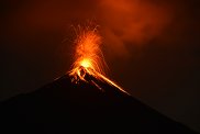
Fieldwork on Volcán de Fuego
Volcán de Fuego in Guatemala is one of the most active volcanoes in the world. Its frequent eruptions are spectacular to watch, but they also gradually build steep deposits of ash and lava fragments on its flanks. From time to time, this material becomes unstable and collapses, sending hot flows known as pyroclastic density currents down the slopes of the volcano.
While eruptions at Fuego are closely monitored, these collapse-generated flows remain less understood. Our project, a collaboration between Guatemalan scientists, local institutions and international partners, investigates the timing and monitoring of these collapses.
BGS Volcanologist Dr Symeon Makris reflects on a recent expedition to Guatemala as part of this project.
|
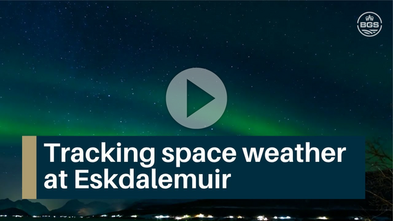 Eskdalemuir is one of three permanent geomagnetic observatories in the UK, alongside Hartland and Lerwick. Together, they form part of a global network that contributes to international research into the planet’s magnetic field. Long-term, high-quality magnetic records are essential for navigation, forecasting and managing the impacts of space weather.
|
|
|
|