What’s happening next?
Over the next few weeks, our surveying team will be out and about in Langstone to gather information that keeps our plans accurate and up to date. We’ll be carrying out two surveys—one to record ground levels and key features, and another to confirm the latest locations of underground pipes and cables within the scheme area.
Underground utility survey
An underground utility survey helps us locate and map buried services—such as water pipes and electricity or telecoms cables—using specialist equipment to identify where they are and estimate depth.
By understanding what’s underground before construction starts, we can reduce the risk of accidental strikes, limit supply interruptions, keep everyone safe, avoid delays, and make any design tweaks early.
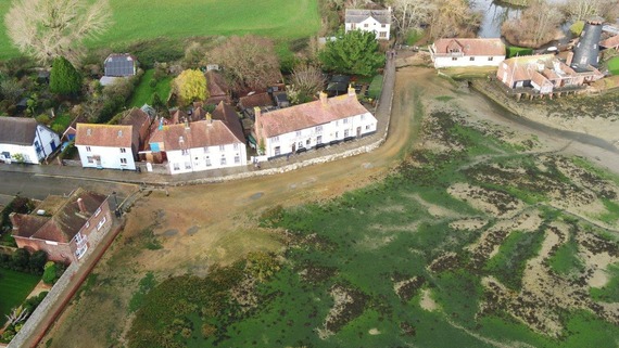
LiDAR drone (UAV) survey
We’ll also be using a LiDAR drone survey across the site. LiDAR uses laser scanning to create a highly accurate 3D models that capture ground levels, structures and other features. These surveys help finalise the design, and plan the build, they also provide a baseline for tracking progress once works begin.
Planning application and construction contractor
We’re in the final stages of selecting our construction partner to deliver the works. We’ve had strong interest from high-quality coastal specialist contractors, and we expect to announce our preferred bidder soon.
We’re also close to a date for the planning committee meeting, where the Local Planning Authority will decide on the planning application.
|